Day 2: A Sea of Cloud and a Historical Road
Route:Oeyama Green Lodge > Onitake Inari Shrine > Oeyama Green Lodge > Miyazu Kaido Road > Fuko Pass > The old Fuko Trail
Total distance: 10 km by car and 8 km walking
Total time: approximately 4 hours
・Sea of Clouds at Onitake Inari Shrine
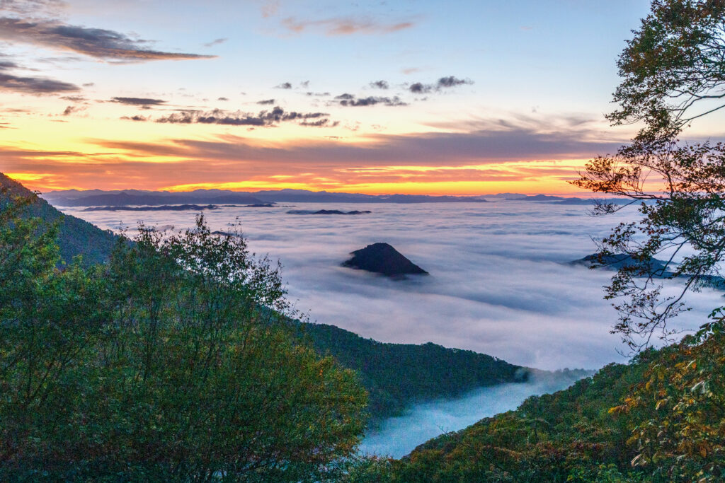
The second day starts with the highlight of our trip. In the dark before dawn, we jump in the car and head to Onitake Inari Shrine at the eighth station of Oeyama, a popular vantage point for the famous sea of clouds.
A “sea of clouds” is indeed an apt description for the layers of clouds and thick fog that unfold mystically below like an ocean. This phenomenon only occurs under certain meteorological conditions, and with fog forming easily at the foot of Oeyama (due to the rich waters of the Yura River and its tributaries) and a significant difference between day and night temperatures, the conditions here are just right.
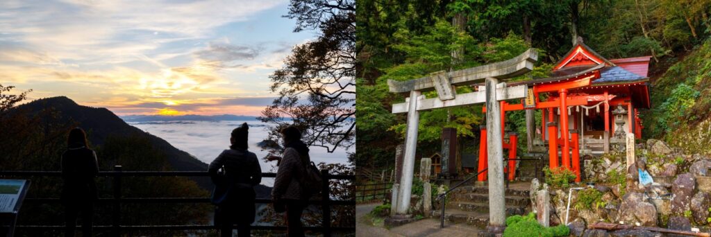
The best time to catch the sea of clouds is early morning in autumn or early winter. The view is truly breathtaking—mountain ridges peek through the clouds like islands dotted in the ocean against a canvas of orange and pink skies, and it only becomes more mystical as the sun rises and shines through the clouds.
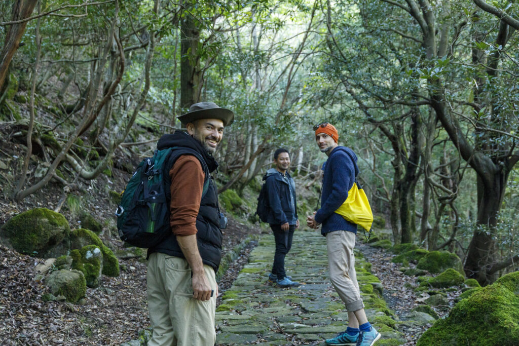
・Miyazu Kaido: Treading a 400-year-old path
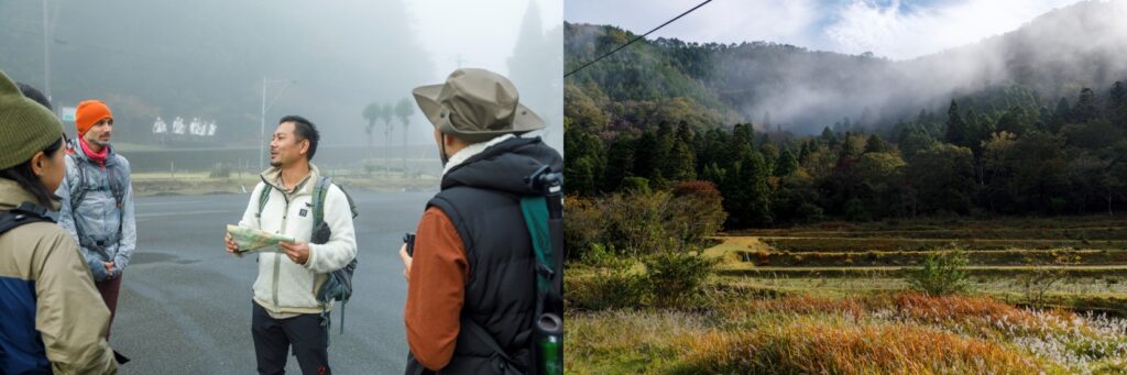
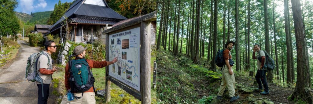
At 8am we’re back at the lodge for breakfast before departing for the second day’s hiking. Because the altitude here is lower than at Onitake Inari Shrine, the lodge is still surrounded by the sea of clouds. We set off through the fog.
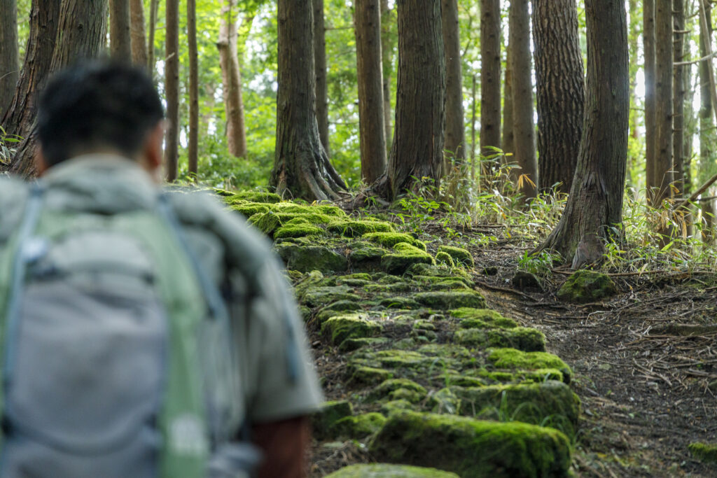
Our itinerary for Day 2 will take us along two historical roads in the Oeyama Mountain Range. The first is Miyazu Kaido, a road built through Oeyama in the early 17th century to connect the town of Miyazu on Kyoto’s northern coast to the highway going to the capital of Edo (present-day Tokyo).
The mossy cobblestones on the path are the very ones that were laid 400 years ago. If you need to catch your breath, there are some enormous thousand-year-old cedars and a waterfall along the way that make nice rest spots. Keep an eye out for the sites of a former Edo-period checkpoint and fort that serve as reminders of the route’s importance in days gone by.
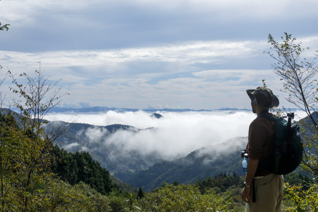
There are also some stunning views along the way, and thanks to the higher altitude here, we catch another glimpse of the sea of clouds. Nature continues to weave its magic even though it has been more than three hours since sunrise!
・The Fuko Pass and ocean views
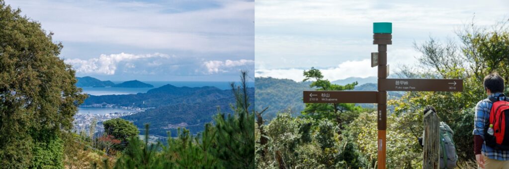
Next, we traverse the Fuko Pass. The mountainside here was excavated for a now-defunct ski ground, so there are magnificent panoramic views to be had of the surrounding mountain range. We also catch a glimpse of the Sea of Japan through the trees as we begin on the road down.
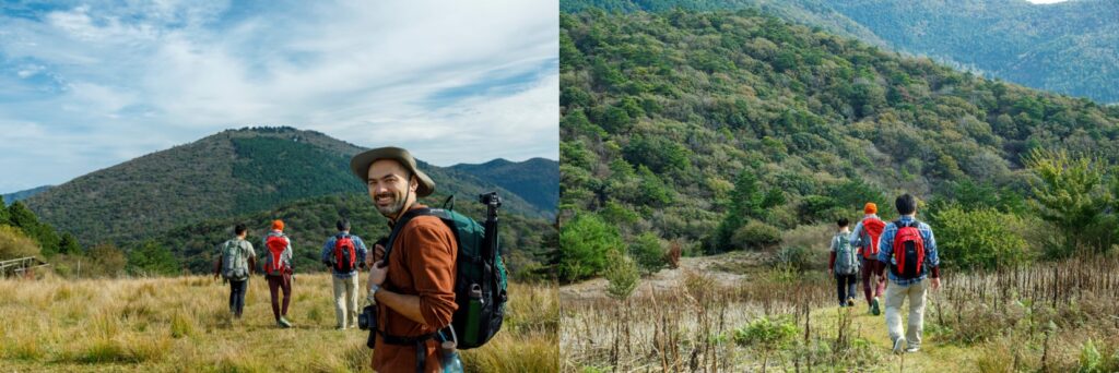
The most spectacular view on the route is from an outlook point called Chayaganaru, which lies at the intersection of The Old Fuko trail (see below) and a trekking route that traverses nearby mountains. You can see Miyazu township, the ocean, and the famous Amanohashidate sandbar from here.
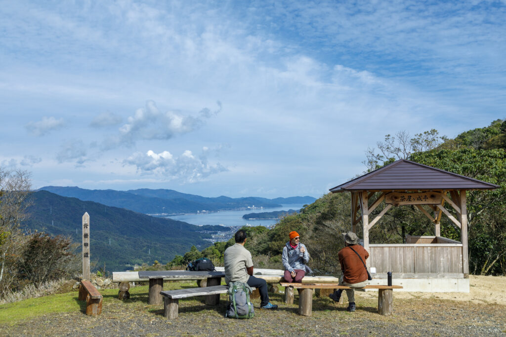
Our guide explains that Chayaganaru was the site of a tea house in the road’s heyday. Imagine the travelers from afar who must have rested here before heading on to Miyazu, and folk setting out from Miyazu, bidding a silent farewell to home and family as they took a last glimpse at the town in the distance.
・The Old Fuko Trail: Stepping back 1000 years
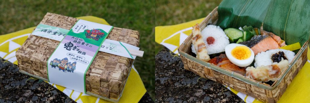
Lunch today is a punnily-named Onigiri bento lunchbox from Oeyama Green Lodge. The face of an “oni” decorates the old-fashioned bamboo sheath box, which is packed with “onigiri” (rice balls) and other colorful items. There’s nothing quite like enjoying a delicious meal in the great outdoors!
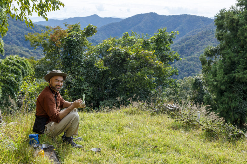
Our stomachs full, we set off for the last leg of our trek down the mountain by way of the Old Fuko Trail.
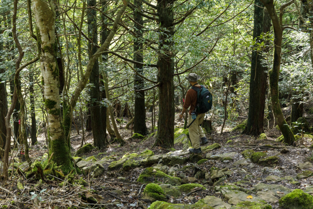
This road has been used to traverse Oeyama for over a thousand years since around the time the capital was established in Kyoto and is mentioned in some old tales. It’s interesting to note that the stone paving here is of a simpler, more rustic style than the Edo Period path that we encountered earlier. Soft sunlight, a babbling brook and chirping birds make for a very peaceful walk along this section.
The trail’s name comes from a large temple called Fuko Temple that once existed near here to venerate the Oeyama mountains. Despite the remote location, it was apparently an enormous complex with close to sixty halls.
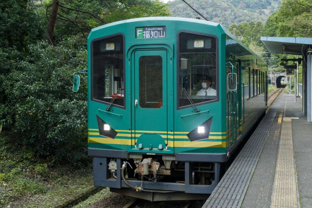
Our final destination is Karakawa Station on the Kyoto Tango Railway. Here we board the train and head for home, gently swayed by the little carriage as it weaves its way back and forth through the mountains.
The two-day hike was an amazing opportunity to experience nature, history, and a lesser-known side of Kyoto, all within a relatively short distance that makes the itinerary ideal for beginners. At the time of writing, maps and signposts on the trails are still in the process of being upgraded to include multiple languages, so for the time being a guided tour is probably the safest option if you’re not confident in your Japanese ability. Since there are any number of potential routes for hiking around Oeyama, a guide can also help put together a plan to fit your individual needs. Visit the website below for details.
https://www.kyototourism.org/en/adventuretours/
Google Map