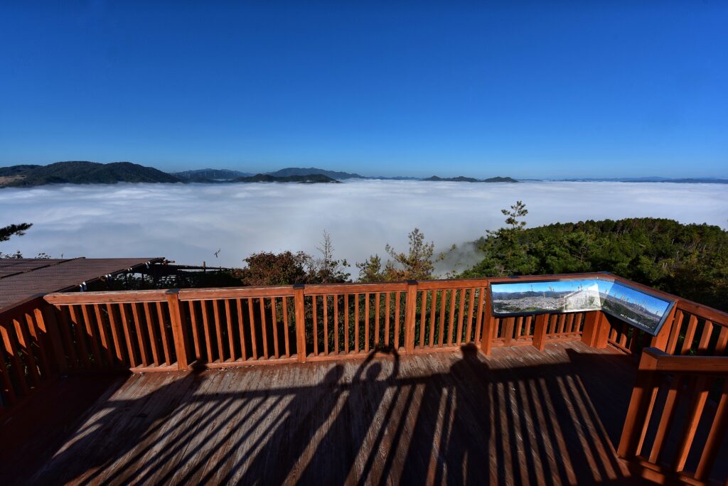
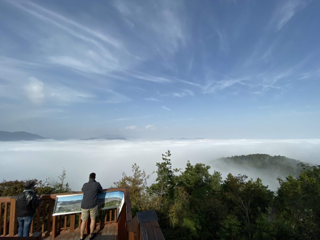
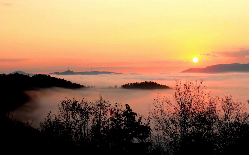
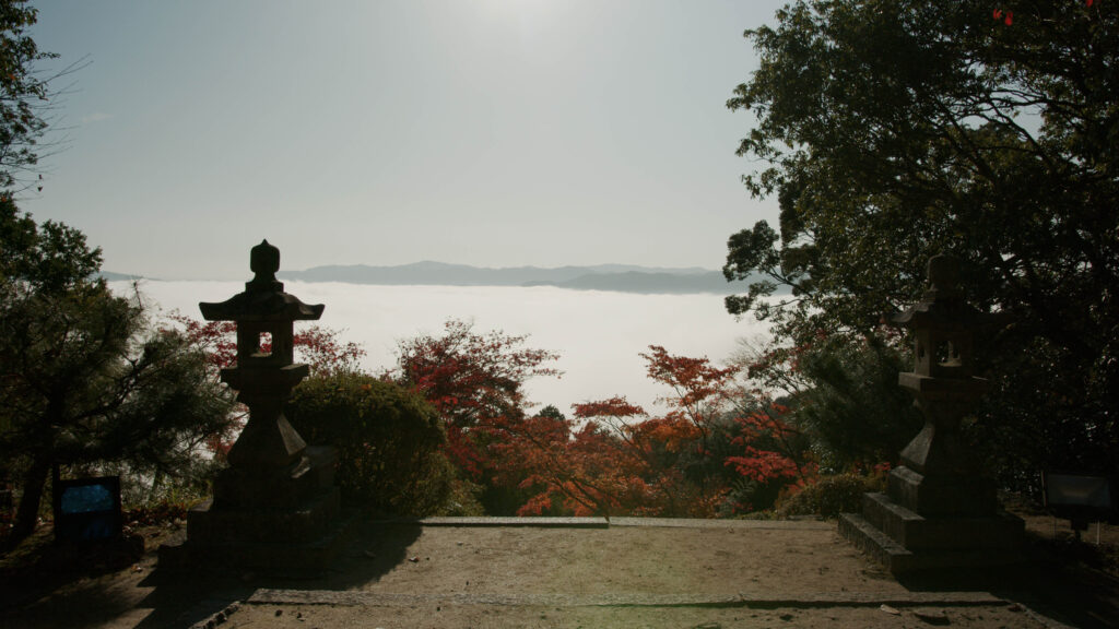
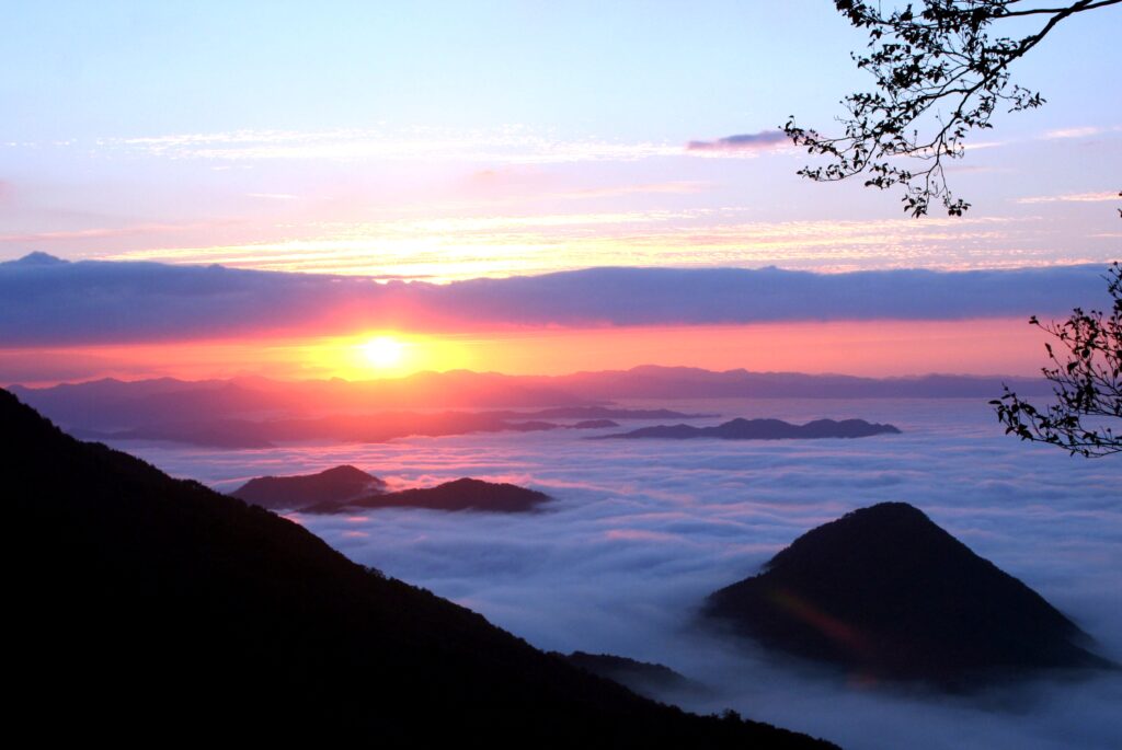
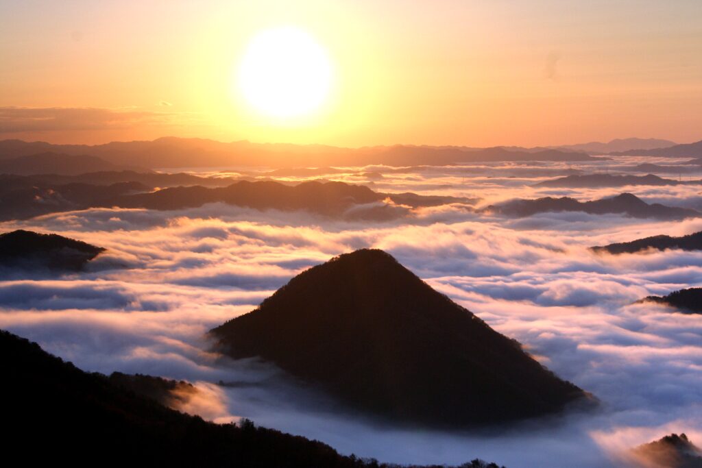
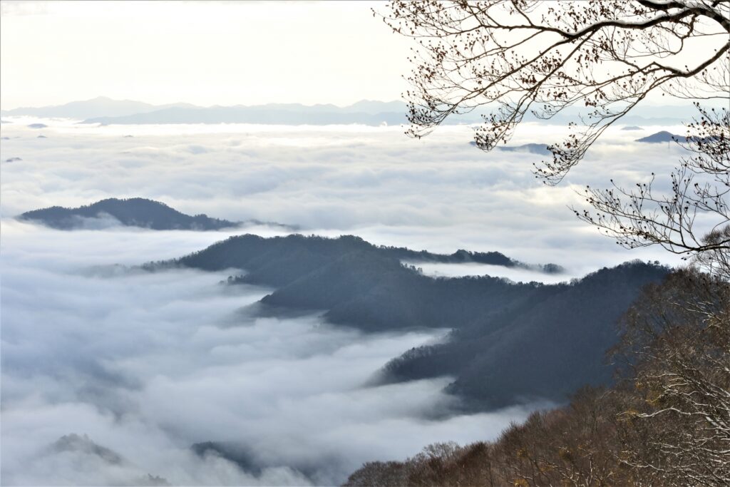
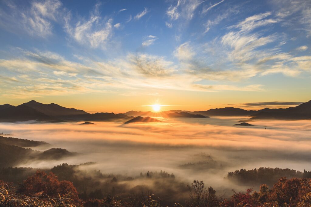
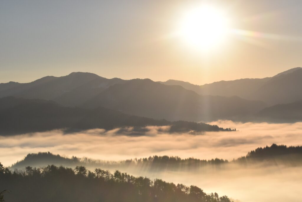
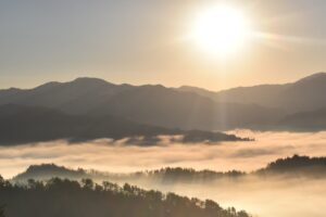
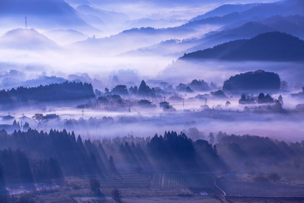
Inspiration

Five Great Spots in Kyoto Prefecture to Enjoy the “Sea of Clouds”

2021.11.25

Woodland Kyoto

One of the most dramatic sights you can experience in the mountains is the “sea of clouds,” in which you peer down from a mountain onto the tops of clouds filling a valley below. Being a mountainous country, it’s hardly surprising that this phenomenon is common in Japan, where it’s called “unkai” (written with the characters “un” 雲 for “cloud” and “kai” 海 for “sea”).

Despite being surround by mountains on three sides, Kyoto City itself is not a great place to see unkai, but a short train or car ride into the mountains north and west of the city will bring you to some great places to check out unkai. The wide valley of Kameoka, just over the mountains from Kyoto’s Arashiyama district, is an excellent place to get “above the clouds.” Other spots can be found further up the Sagano-San’in railway line that heads northwest through Kyoto Prefecture.

Conditions for Unkai

Unkai occurs when cool, humid air is trapped in a valley or plain below drier, warmer air. In most places, this happens in the early morning, when the ground has lost most of its heat during the night and warmer air blows in at a higher altitude. In this area, unkai is most common beginning in fall. Your best chance to see it is early in the morning on a sunny day with little wind, when rain has fallen in the previous days.

Preparations for Unkai

Because unkai usually occurs in the early morning, you’re going to have to make some preparations. First, check the weather: Don’t bother going if the forecast calls for rain or overcast conditions. Next, arrange to be at the viewpoint or trailhead very early. For sites you can drive to, this isn’t too tricky, but for sites you must hike to, this means a pre-dawn start. Staying near the trailhead is a good idea, and headlamps and some warm gear are essential.

There are many great sites in Japanese with detailed hiking maps and downloadable tracks, including Yamap. If you don’t read Japanese, Chrome’s translate feature can get you pretty far with this site. If you prefer English, Wes Lang’s Hiking in Japan site is excellent.

Kyoto’s Top Five Spots for Unkai

◆Kameoka Fog Terrace

For those who don’t fancy a pre-dawn hike, the best way to see unkai near Kyoto City is from the Kameoka Fog Terrace. This free viewing terrace is 380m high on a shoulder of a mountain overlooking the Kameoka bonchi. With an early start from Kyoto, you can get here by rental car in time to see the unkai magically illuminated from below by the lights of Kameoka City. Seeing ridge after ridge of mountains rising above the clouds is a one of the great views in Kyoto. And, if the unkai isn’t working, you can still enjoy the twinkling lights of the city below. There’s also a live cam of conditions on the Fog Terrace available here on the Kameoka Tourism Association Website (website in Japanese).

Access:
The Fog Terrace is only accessible by car. From central Kyoto in normal conditions, the drive takes about an hour (faster if you set out before the morning rush hour). From central Kyoto, take Rt. 9 west and then Rt. 478/the Kyoto Junkan Expressway. The Fog Terrace is about 10 minutes from the Kameoka IC, just past the Kameoka Country Club.

The Fog Terrace

The Fog Terrace

The “Tamba Fog” that appears across the Kameoka Basin from autumn to spring is a unique sight for which Kameoka is known. In the morning in particular, the scenery as viewed from the Fog terrace is w …

◆Senju-ji Temple on Mt. Tokonage

Located in the small city of Kameoka, about 20km west of Kyoto City, 445m Mt Tokonage (獨鈷抛山) offers an amazing view over the Kameoka “bonchi” (flat basin). It takes about two or three hours to hike from the station to the top of the mountain (so, it’s going to be a really early start if you want to see the unkai).

The trail goes over Mt. Gyouja (430m) and dips down across a saddle before rising up to Senju-ji Temple, which sits just below the main peak. The view from the steps and gate of the temple when the unkai is working is superb, with peaks and ridges floating like islands in the sea. Rather than descending the way you came, many people choose to take the trail down the south side of the mountain, which makes for a pleasant loop.

Access:
Take a local (futsu) train on the JR Sagano-San’in Line from Kyoto Station to Chiyokawa Station. Trains bound for Sonobe will stop at Chiyokawa (it’s two stops past Kameoka Station). The ride takes about 35 minutes. From the station, it’s about a 20-minute walk to the trailhead, and another hour or two to the mountain top.

◆Onitake Inari Shrine on Mt. Oe

This shrine is located at about 600m on the shoulder of Mt. Oe, a towering mountain outside of Fukuchiyama in northern Kyoto Prefecture. It’s a pleasant spot and and is accessible by a narrow mountain road. There’s parking beside the road and it’s a short walk to the shrine. There are some good views over the surrounding valleys and unkai is common in the mornings here. This is a good choice for those who don’t want to do a major hike to see the unkai. But most people will want to continue on to the summit of Mt. Oe (the trail to the summit is well marked from the shrine).

At 832 meters, the summit of Mt. Oe affords magnificent views in every direction over the mountains of northern Kyoto. When the unkai fills the surrounding valleys with white clouds, the effect is truly magical. As you hike, you’ll notice a preponderance of fearsome statues scattered about: this sacred peak is said to be the home of many “oni” (Japanese devils). Note: This hike is best done from April to October (in other months, it’s likely to be covered with snow).

Access:
The parking lot for Onitake Inari Shrine is about one-hour’s drive north of the town of Fukuchima via Rt. 9. Fukuchiyama is, in turn, about two hour’s drive northwest of Kyoto.

Mt. Oe

Mt. Oe

The Oeyama mountain range is known throughout Japan for its monster-slaying legends, and it is also a vast and rich natural environment. There is something fun to do in each season, including hiking w …

◆Yakuno Highlands

Located in the caldera of an ancient volcano on the border of Kyoto and Hyogo Prefectures, the 300-meter-high plateau of the Yakuno Highlands is a brilliant place to enjoy the unkai in the early morning. The best place in the area to enjoy the view is Hozan-koen Park (宝山公園). The park is about 15 minutes’ walk northwest of Kami-Yakuno Station (see following for transport details). Those feeling energetic can hike up to the summit of Mt. Takura (田倉山), which is famous for the views of what the Japanese call “sha,” the effect of columns of sunlight shining through broken clouds (best observed in the late afternoon and early evening).

Access:
Yakuno Highlands are located about 10 kilometers west of the Fukuchiyama in northern Kyoto Prefecure. Kami-Yakuno is the most convenient train station for the area, and it’s about a 25-minute journey on the JR Sagano-San’in Line from Fukuchiyama. While the area is accessible by train, a rental car will certainly make exploring easier.

Yakuno Highland

The Yakuno Highland, located in Yakuno-cho, Fukuchiyama City in the northwest of Kyoto Prefecture, is a highland area created by a volcanic eruption of the prefecture’s sole volcano, Mt. Takura (Mt. Takara).
The Yakuno district is located on the border with Hyogo Prefecture, surrounded by nature and mountains of some 700 meters in height.
In spring, many people come to see the weeping cherry trees at the Kyoto Prefectural Tree Planting Center, commonly known as the “weeping cherry of Yakuno-cho.”
Once the cherry blossom season has ended, Shirai Omachi Wisteria Park in neighboring Asaku City, Hyogo Prefecture sees a bloom of wisteria the greatest of its size in the mountains here. In summer, the Yakuno area becomes a retreat from the heat, and in autumn the leaves are a colorful sight. With its beautiful natual scenery throughout the four seasons, the Yakuno area is visited by many throughout the year.
At Nosho-no-sato Yakuno Roadside Station in particular, visitors can enjoy some of the best of Woodland Kyoto with its hot springs, overnight accommodation, activities, dining, and shopping.

◆Mt. Kimino-o

Another great unkai spot in northern Kyoto Prefecture is Mt. Kimino-o (君尾山), a 581m peak in the Oku-Kanbashi (奥上林) area, just outside the town of Ayabe. Komyo-ji Temple (光明寺) is a short walk up from the gate and it offers some decent views over the valley, which is often covered with unkai in spring, summer and fall. But, for the best unkai views, you’ll want to keep climbing up the ridge. Before you get to the summit, you can take a detour to see the famous Otochi (giant chestnut tree), which has a circumference of over 10m and is said to be over 2,000 years old. If you’re in a hurry to see the unkai, then leave the Otochi for the return trip. The view of the unkai and surrounding peaks from the summit is spectacular. And, to top it all off, you can have a soak in Ayabe Onsen after you’re all done.

Access:
This area is best accessed by car from Ayabe, which is a 90-minute drive from Kyoto City under normal conditions. Drive east for 30 minutes from Ayabe and look for the signs for Nio-koen Park. Continue past the park in the direction of the Nio-mon Gate for Komyo-ji Temple. You can leave your car there while you hike up the peak.

Mt. Kimino-o

Mt. Kimino-o

Mt. Kimino-o is a mountain with an elevation of 582 meters, located in the Kanbayashi area northeast of Ayabe. If you climb Mt. Kimino-o in autumn or winter, you can see the mountains of the Tamba are …